A holiday in Iceland often includes a scenic drive on the Golden Circle route, where you can stop at stunning glacial lakes, black-sand beaches, and cascading waterfalls. The surreal Icelandic landscape is a dream destination for many photographers, amateurs and professionals alike.
It takes over a week to explore this Nordic island, but a shorter trip is possible if you’re pressed for time and just want to hit up some of the country’s most popular spots. We’ve narrowed the huge selection down to just 10 epic locations you have to visit in Iceland – remember to snap lots of photos while you’re there.
- 1
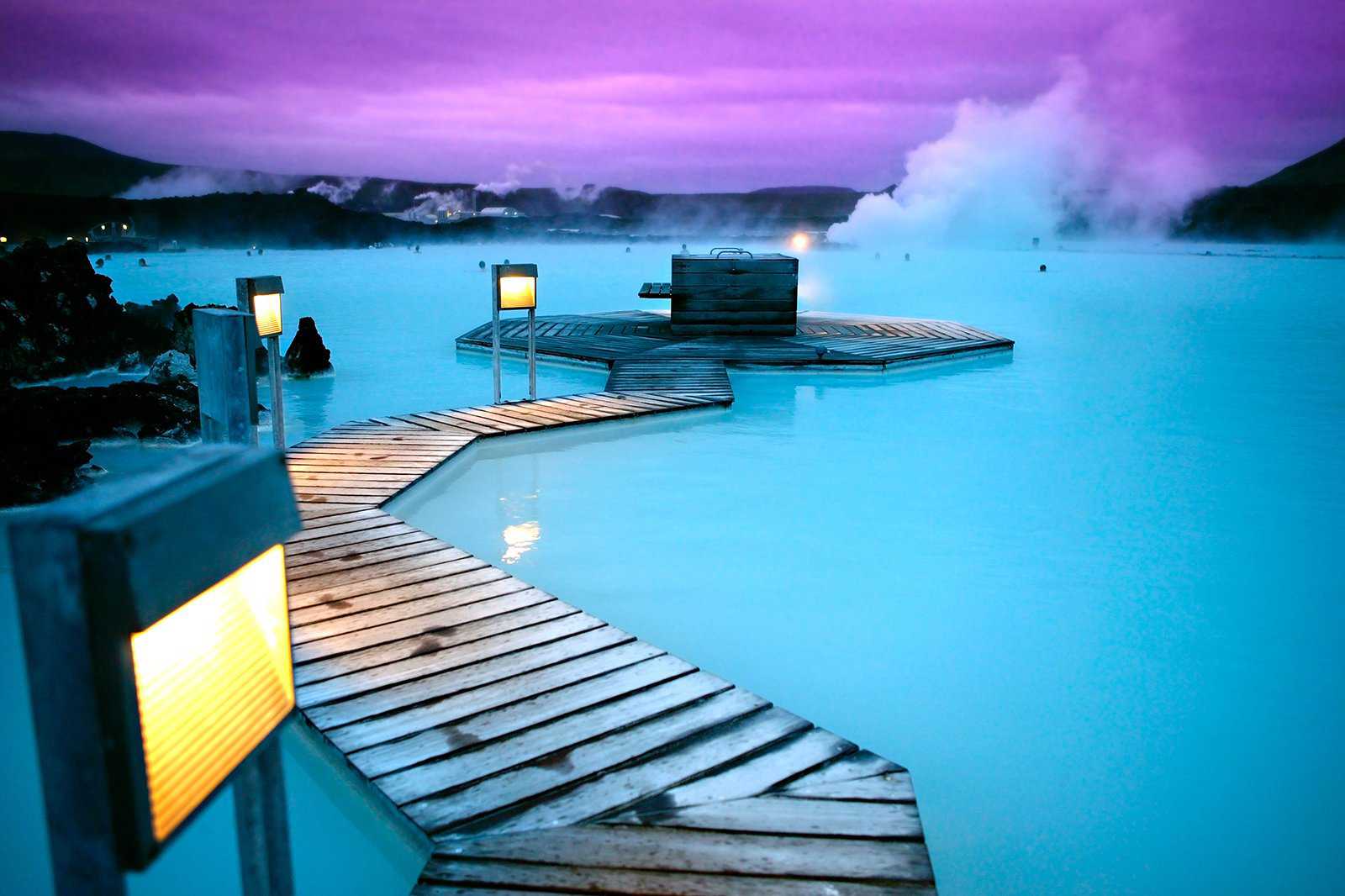
Blue Lagoon
Take a dip in turquoise waters
- Adventure
- Photo
The iconic Blue Lagoon is one of Iceland’s most recognisable locations. The geothermal spa is rich in silica, minerals and algae, which contain healing properties. It’s also popular among photographers thanks to its misty surroundings, bright turquoise waters, and volcanic landscape.
The Blue Lagoon stays open year-round, and is most crowded during the summer (June–August). The spa is quite large, so you’ll still be able to find a spot with relatively few people if you’re feeling timid.
Location: Blue Lagoon, Grindavik, Iceland
Map - 2
Seljalandsfoss
Iceland’s highest waterfall
- Adventure
- Photo
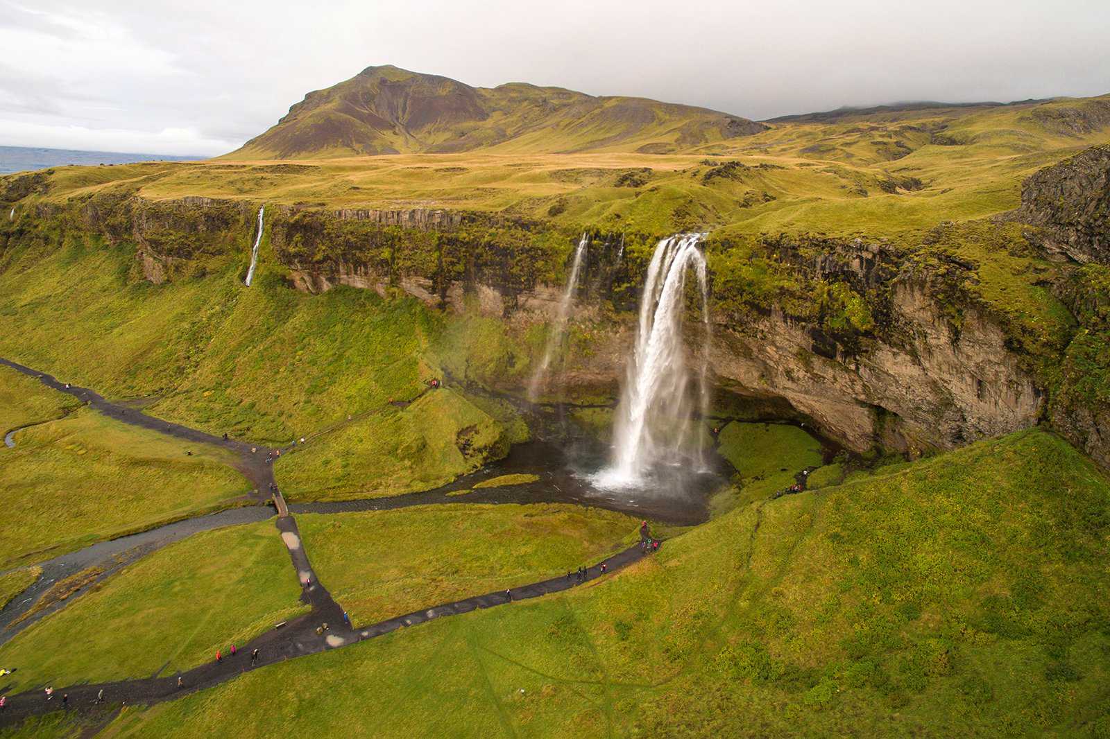
The Seljalandsfoss Waterfall is a prominent landmark along the Ring Road, Iceland’s main highway. Its waters cascade from a 60-metre-tall cliff. What makes it unique among the many waterfalls in Iceland is its pathway, which allows you to walk around the falls – even taking photos from behind the water.
Wear waterproof clothing and secure your belongings before getting close to Seljalandsfoss – you will definitely get wet from the relentlessly cascading waters. Located along Iceland’s southern coast, this impressive waterfall is about 120 km southeast of Reykjavik.
Location: Seljalandsfoss Waterfall, Þórsmerkurvegur, Iceland
Map - 3
Reynisfjara Basalt Columns
Hexagonal basalt rock as far as the eye can see
- Adventure
- Photo
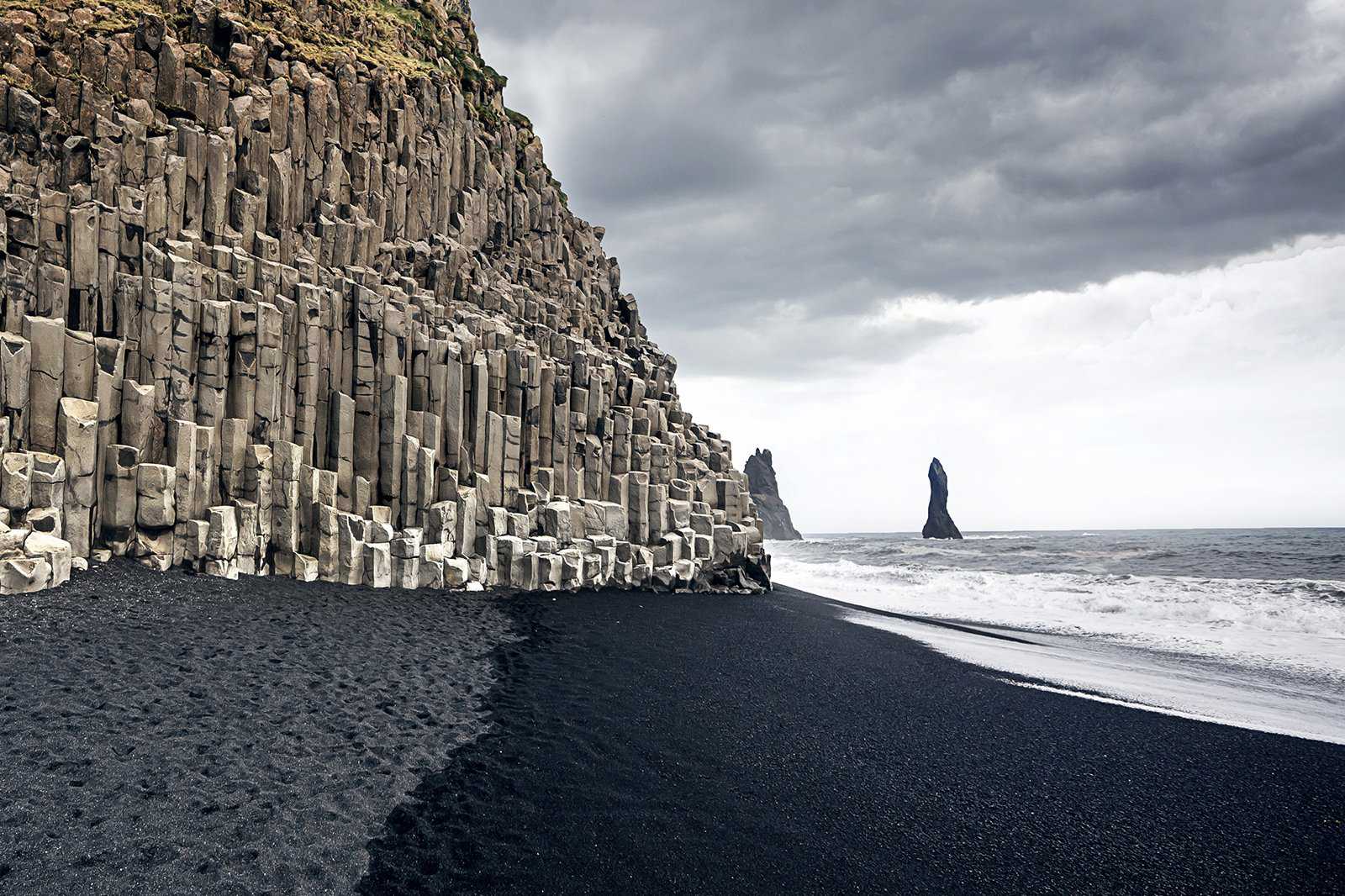
Reynisfjara is a coastal landscape of black sands and geometric columns overlooking the Atlantic Ocean. Shaped like gigantic organ pipes, one can be fooled into thinking the columns are manmade, but they’re entirely natural – the result of basaltic lava that’s been cooled over a period of time.
The rocks are sturdy enough for climbing, but be careful as some parts can be slippery. Apart from being a popular spot for photography, the Reynisfjara basalt columns are home to thousands of nesting seabirds, including puffins, guillemots, and fulmars.
Location: Columnes Reynisfjara, Reynisfjara Beach, Iceland
Map - 4
Crystal Ice Caves
One of the largest glacier caves in Iceland
- Adventure
- Photo
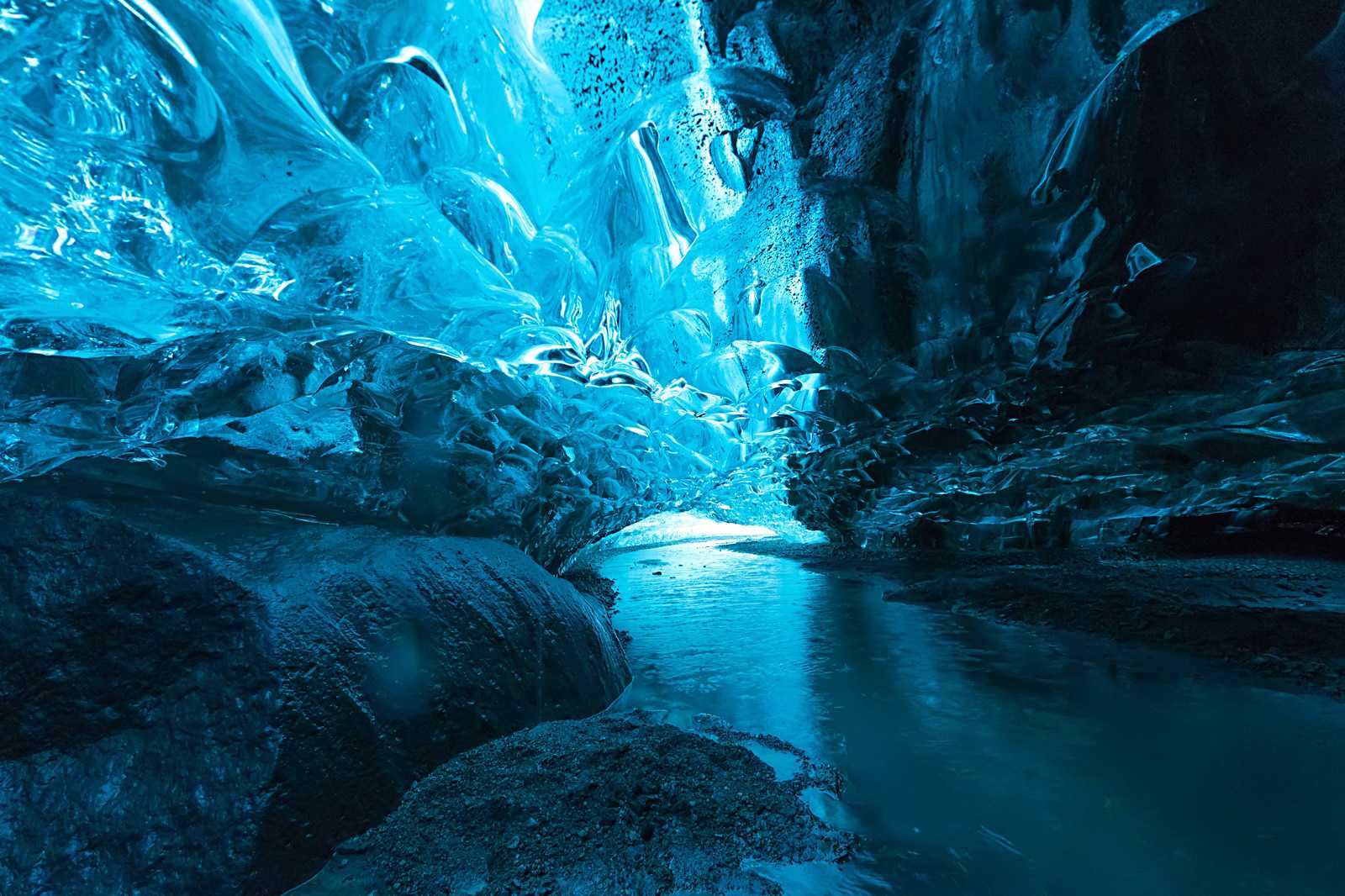
The Crystal Ice Cave in Vatnajökull Glacier is one of Iceland’s largest, boasting a maximum capacity of up to 100 people. The cave changes locations and shapes every year, as extreme temperatures cause the glacial waters to freeze and melt over time.
You can only explore Vatnajökull’s ice caves on guided tours, but you’ll be amazed by views of vivid blue walls and icicles in unique shapes. Near Crystal Ice Cave is a smaller cave, called the Dark Rubin – instead of blue, this ice cave is black in colour.
Location: Vatnajokull, Iceland
Map - 5
Mt. Kirkjufell
A mountain resembling a church steeple
- Adventure
- Photo
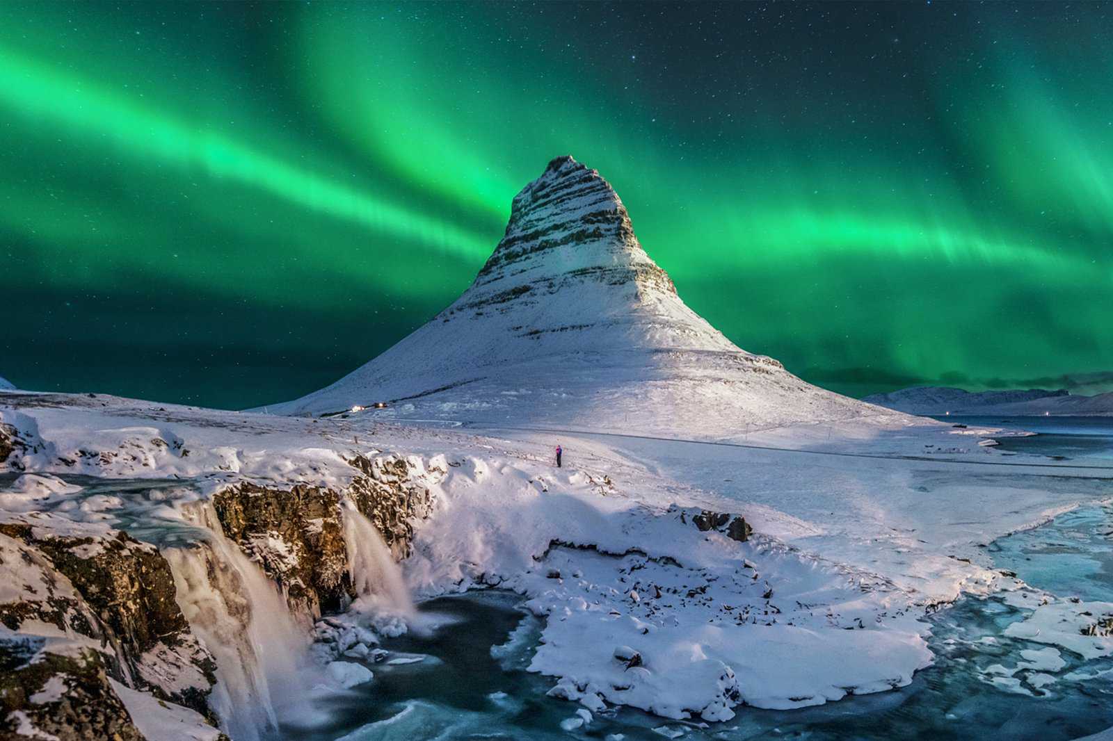
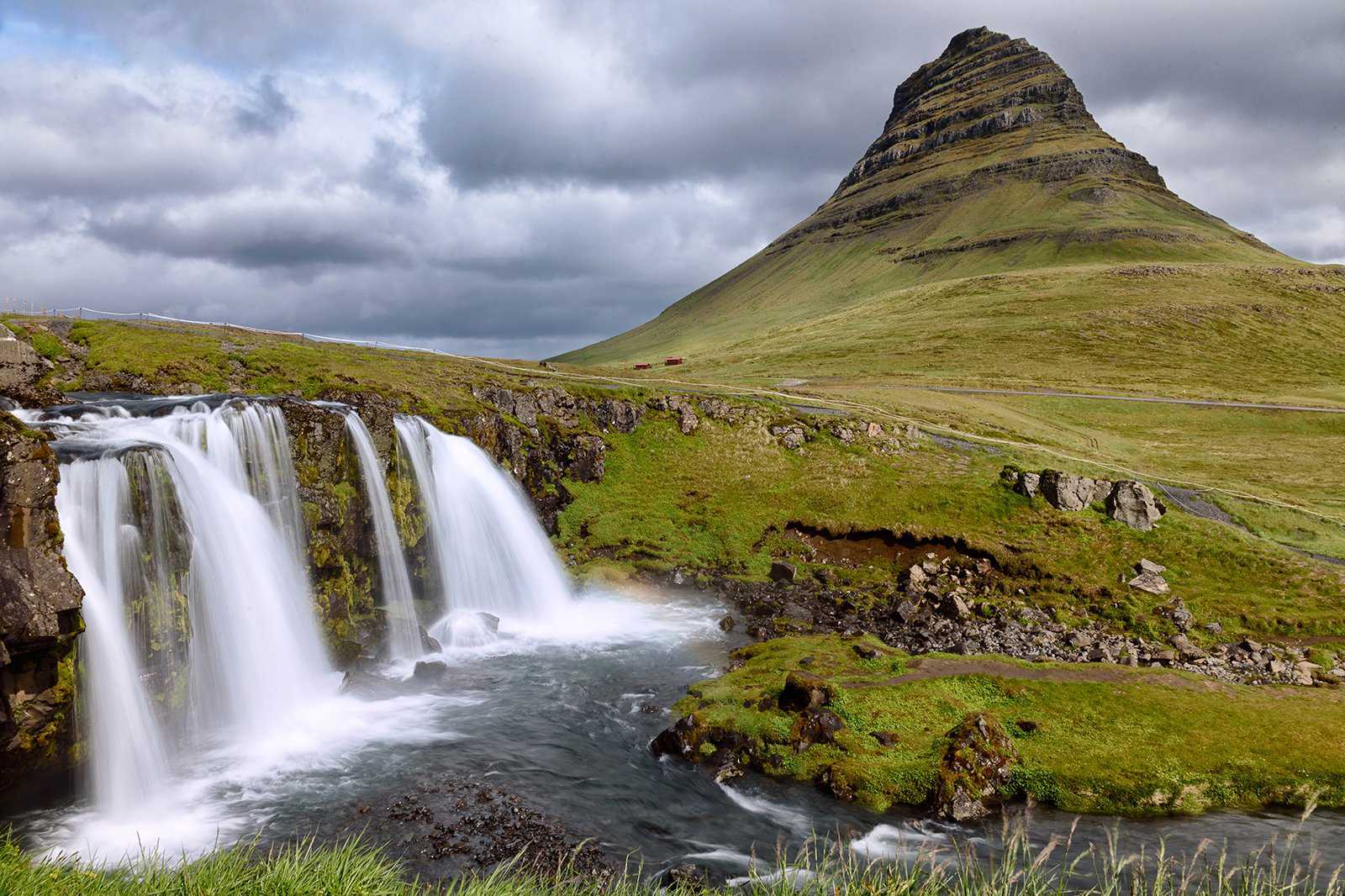
Mt. Kirkjufell dominates Iceland’s Snæfellsnes Peninsula with an impressive height of 463 metres. Its name means ‘Church Mountain’ and comes from its shape, which resembles a church steeple. Over the years, Mt. Kirkjufell has been featured in many films and TV series, including HBO’s Game of Thrones.
You can visit a lake at the mountain base, where the calm waters reflect a mirror-like image of the mountain. If you love hiking, it takes around 1.5 hours to reach the summit, where you can enjoy panoramic views of the Icelandic landscape and the Atlantic Ocean. It’s possible to see the Northern Lights if you’re there between September and April.
Location: Snæfellsnesvegur, Iceland
Map - 6
Vatnajokull National Park
Hike to Skaftafellsjokull, Iceland’s largest glacier
- Adventure
- Couples
- Families
- Group
- Photo
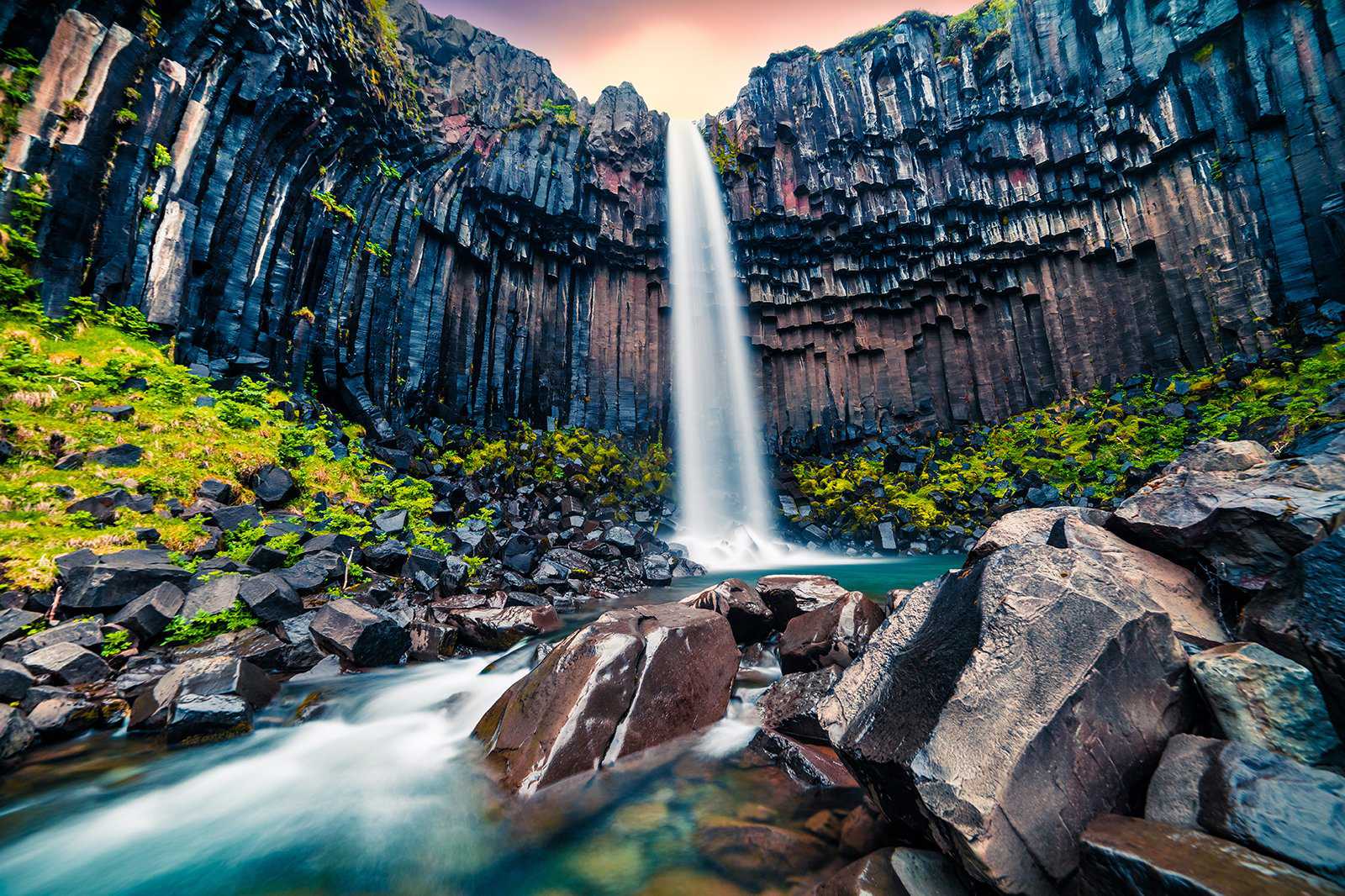
Vatnajokull National Park attracts hikers with scenic trails leading to glaciers, rivers, and waterfalls. It covers over 14,000 sq km, making it one of the largest national parks in Iceland. There are 4 visitor centres and plenty of camping grounds throughout the park.
Skaftafell, at the southern end of Vatnajokull National Park, has many picturesque attractions, including hiking trails to Skaftafellsjokull (Iceland’s largest glacier) and the 20-metre-tall Skaftafoss Waterfall. There’s a visitor centre here, where you can pick up maps and hiking routes, as well as enjoy exhibitions about the glaciers and volcanoes in the area.
Location: Klapparstígur 25-27, Iceland
Map - 7
Strokkur
An active geyser in Haukadalur Valley
- Adventure
- Photo
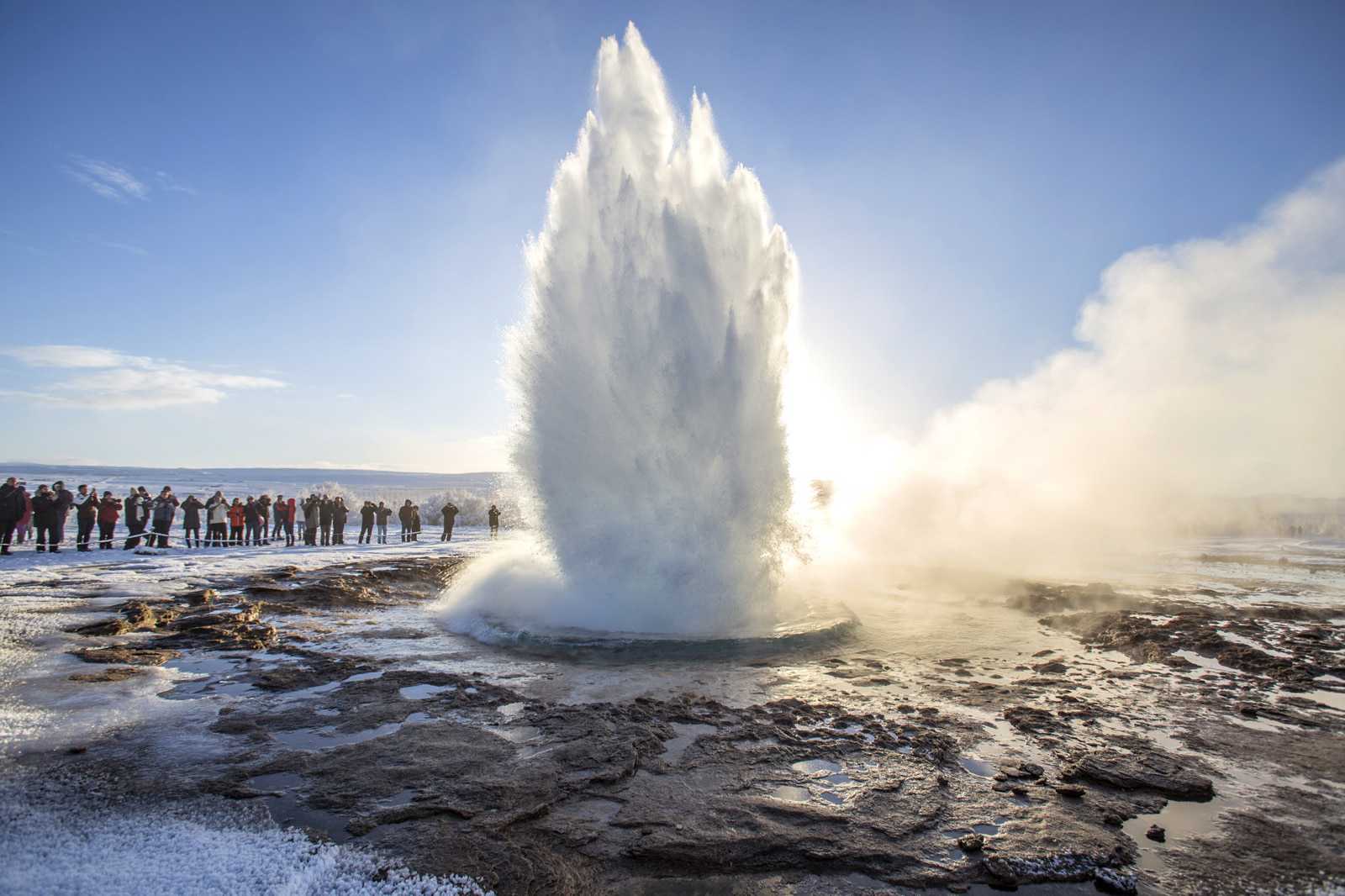
Strokkur is an active geyser within the Geysir Geothermal Area. It erupts every 5 to 10 minutes, with the boiling water reaching heights of up to 40 metres. The geothermal site is a vivid landscape of yellow, red, and green, thanks to the presence of minerals such as copper, iron, and sulphur in the soil.
As there aren’t many active geysers in the world, those travelling on the Golden Circle Road often make a stop at Strokkur to see this rare natural phenomenon. Be careful not to step in pools within the site as the geothermal waters are intensely hot.
Location: Geysir, Hafnartún, Selfoss, Iceland
Map - 8
Hvitserkur
A basalt rock formation in Húnaflói Bay
- Adventure
- Photo
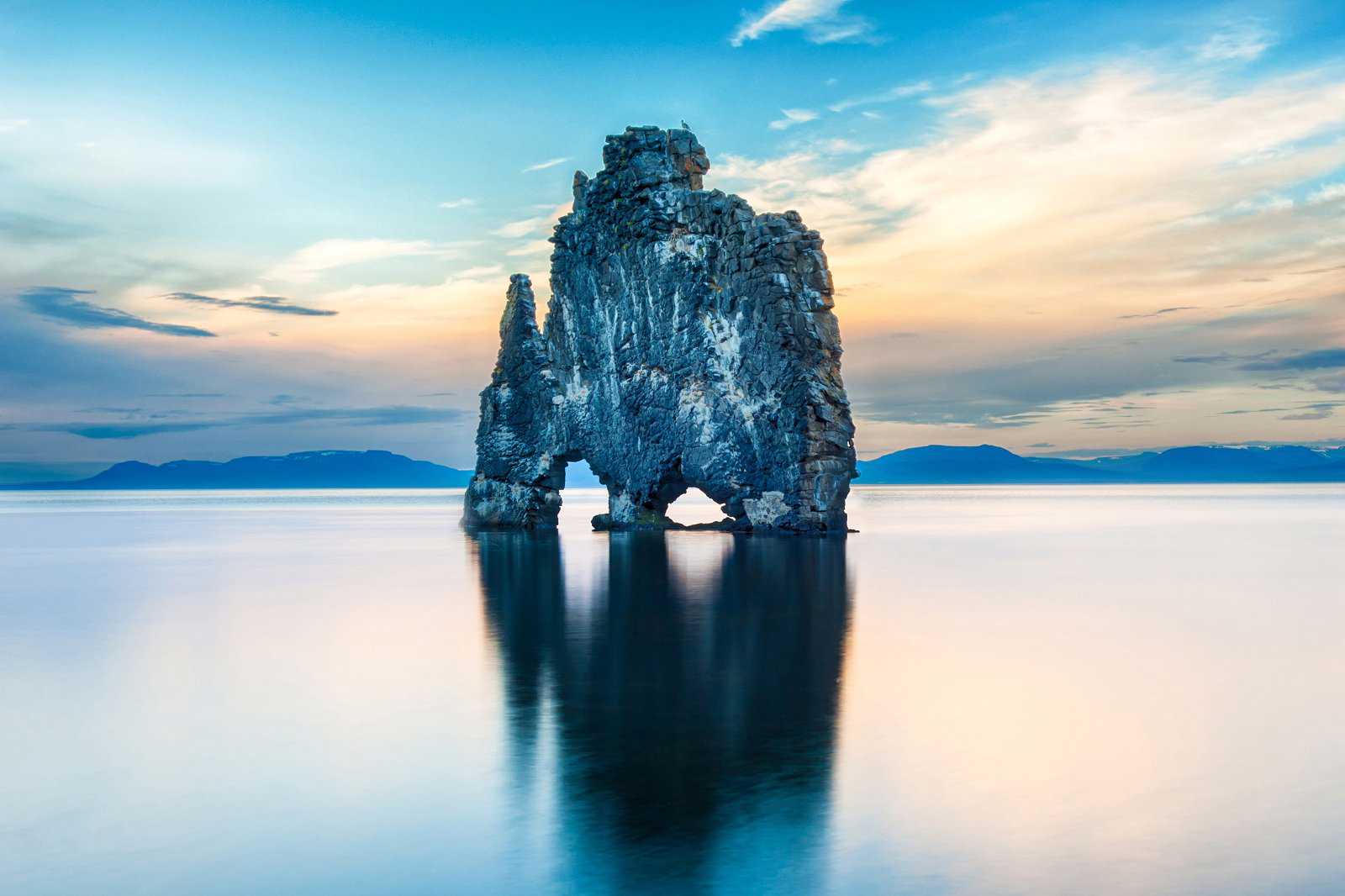
Protruding from Húnaflói Bay is Hvitserkur, a basalt cliff shaped like a troll (according to the locals’ perspective). The 15-metre-tall formation is visible from several places within the Vatnsnes Peninsula, but most stop at Hvammstangi for views of Hvitserkur and for seal-watching excursions. While you’re here, be sure to head south towards Sigríðarstaðir Beach, where you can find a thriving seal colony.
Location: Hvitserkur, Vatnsnesvegur, Iceland
Map - 9
Jokulsarlon Glacier Lagoon
Spot seals resting on icebergs
- Adventure
- Photo
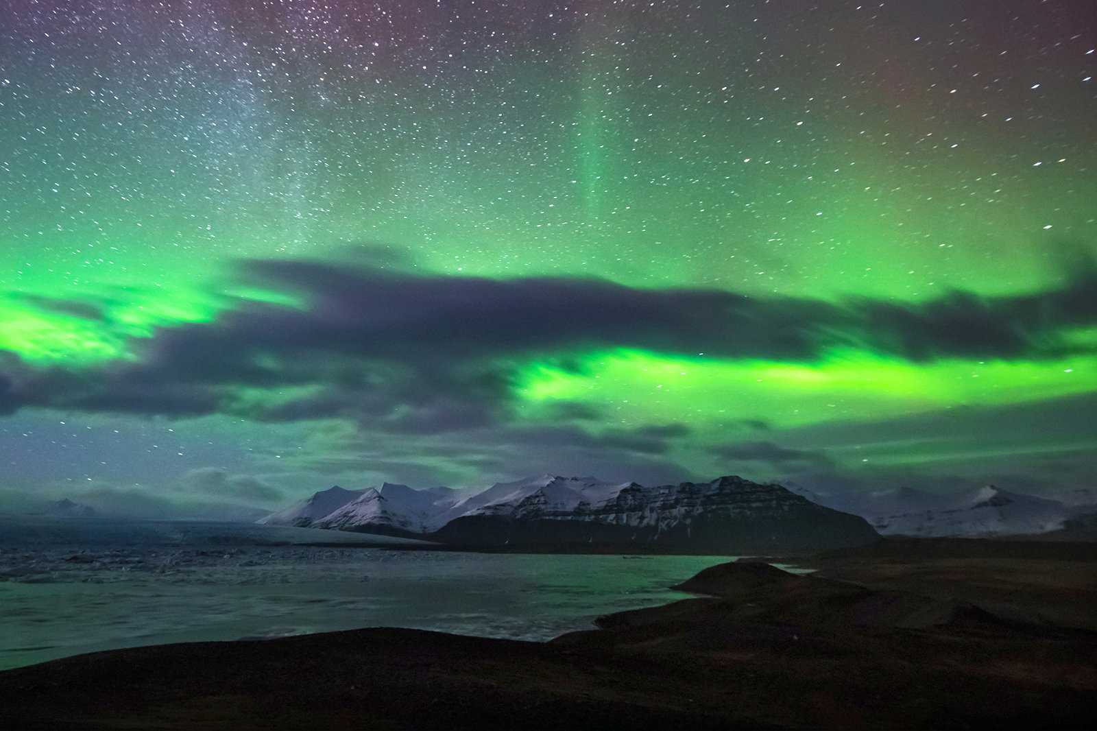
The Jökulsárlón Glacier Lagoon is part of Vatnajokull National Park and is one of the largest ice caps in Europe. You can see hundreds of icebergs of various shapes and sizes floating in the melted glacial water – if you’re lucky, you may even spot wild seals resting on an iceberg.
Another surreal spot you can visit is Diamond Beach, which lies at southern end of Jökulsárlón Glacier Lagoon. Small icebergs from the lagoon travel towards the sea, where the waves erode them until they become transparent. These blocks then float back to the black beach, resembling diamonds twinkling in the sun.
Location: Jökulsárlón Iceberg Lagoon, Iceland
Map - 10
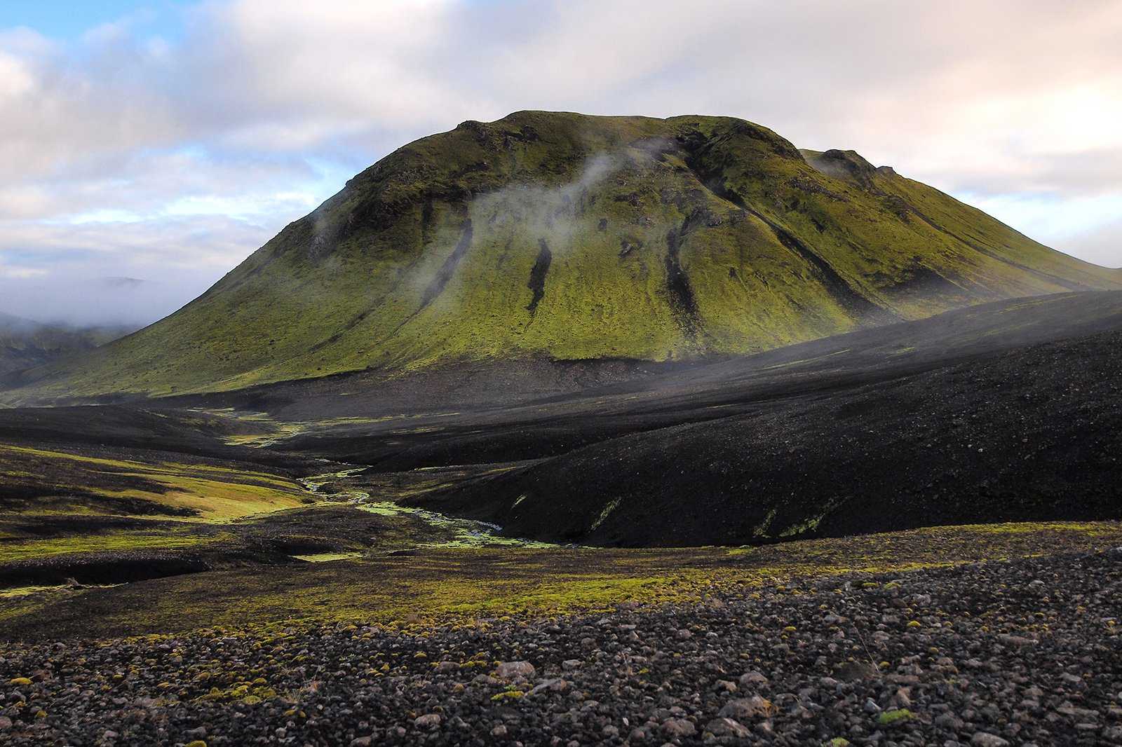
Landmannalaugar
A mountainous landscape in shades of red, green, and yellow
- Adventure
- Photo
Landmannalaugar is a rhyolite mountain range in Fjallabak Nature Reserve, about 200 km east of Reykjavík. Surrounded by lava fields and volcanic craters, the mountain is also called the People’s Pool, thanks to geothermal pools and hot springs dotting its landscape.
Landmannalaugar attracts photographers with the vivid colours of its mineral-rich rocks. The mountain features vivid shades such as golden, yellow, red, pink, blue, and green, thanks to minerals like rhyolite, iron, and sulphur.
Location: Landmannalaugar, Iceland
Map
